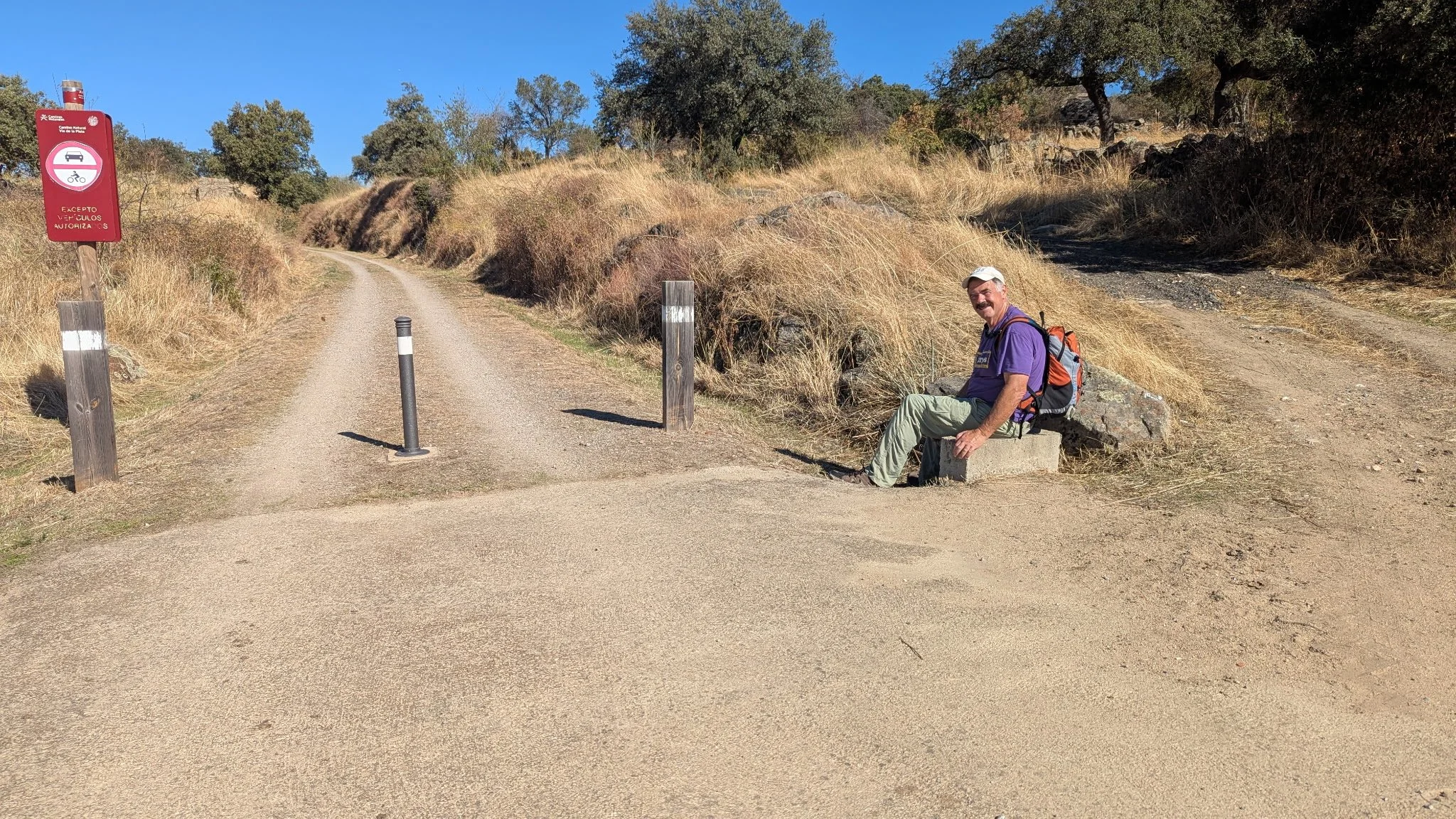
Vía de la Plata — The Silver Route
Seville to Santiago de Compostela
1000km · Four sections · The longest, the oldest, and the most solitary Camino route.
The Roman Road
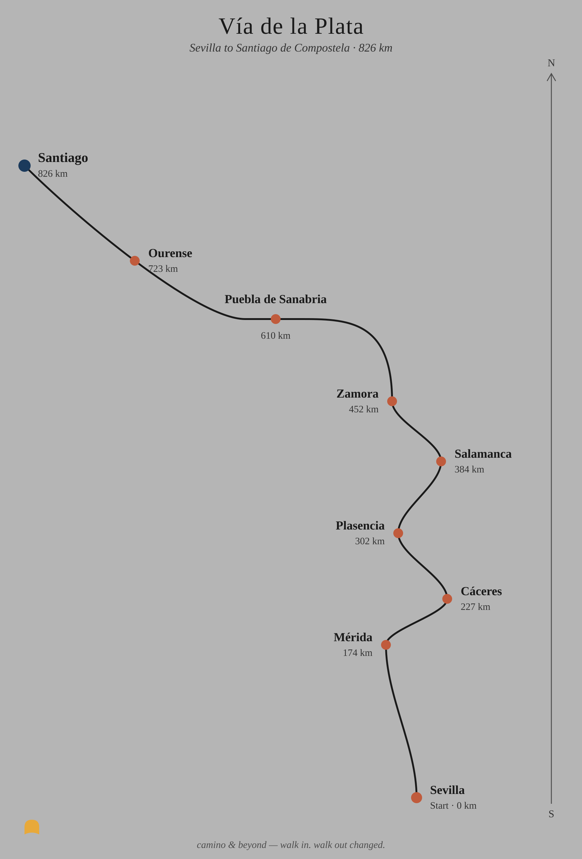
The Vía de la Plata is not the Camino most people know. It begins in Seville, in the heat of southern Spain, and travels almost due north for nearly a thousand kilometres before turning west to Santiago. It crosses Andalusia, Extremadura, Castile and León, and Galicia — four distinct regions, four entirely different Spains. It is long, it is demanding, and for much of the route it is almost empty.
The name comes from the Roman road — Iter ab Emerita Asturicam — built two thousand years ago to connect the silver-mining regions of the south with the Roman north. The road is still largely intact. You walk it.
What this route gives you
The Vía de la Plata gives you Spain in a way no other Camino does. The south is ancient and wide open — Andalusian farmland, cork oak and olive groves, white villages unchanged for centuries. Extremadura is wilder and more remote, the dehesa landscape vast and meditative, punctuated by extraordinary Roman monuments that appear without warning beside the trail. Castile is the meseta in its purest form — wheat plains, long straight roads, the kind of silence that asks something of you. And then Galicia appears, green and damp and familiar to anyone who has walked the Francés, and you know you are nearly there.
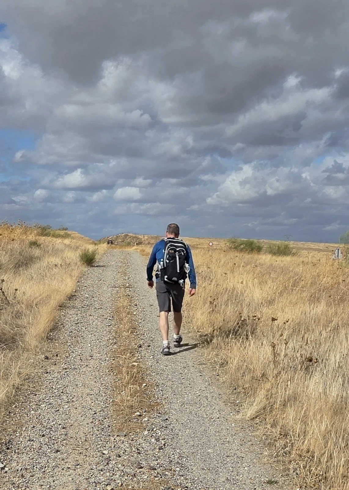
There are far fewer pilgrims on the Vía than on the Francés. Some days you will walk for hours without seeing another person on the road. That solitude is not for everyone. For those it suits, it is the whole point.
Services are more limited than on the Francés — accommodation in some stages requires advance planning, and carrying provisions and water every day is not optional. This is a route that rewards preparation.
We started walking the Vía de la Plata in 2023 and are currently mid-journey, adding a section each year. This guide reflects the sections we have walked personally. We have walked from Seville to Salamanca and will continue from there this November. Its guide will follow.
Stages of the Silver Way
Section 1 — Seville to Cáceres~255km · 10 to 11 days
The southern section. The route leaves Seville through the suburbs and quickly opens into the Andalusian countryside — rolling hills, white villages, cork oak and olive groves. The landscape is wide and ancient and largely unchanged from the Roman period. The Vía de la Plata is not heavily signposted in places — pay attention to the waymarks.
Mérida, roughly three quarters through this section, is the highlight of the entire Vía de la Plata and one of the most extraordinary Roman cities in Europe. The theatre, the amphitheatre, the Roman bridge across the Guadiana — all still standing, all still in use in various ways. Allow extra time in Mérida. It rewards it.
Cáceres at the end of this section is a UNESCO World Heritage medieval city — one of the best preserved in Europe, its old town almost entirely intact within its walls. The contrast with the open farmland of the previous ten days is striking.
Much of the route through the dehesa crosses private farmland — you open and close gates behind you to keep livestock contained. The fields are ancient Holm oak woodland whose acorns feed the black Ibérian pigs that roam them freely. It is one of the most distinctive and unhurried walking environments on any Camino route, and one you will not find on the Francés.
Stages:
Seville → Guillena (21km) → Castilblanco de los Arroyos (18km) → Almadén de la Plata (22km) → El Real de la Jara (14km) → Monesterio (22km) → Fuente de Cantos (22km) → Zafra (19km) → Los Santos de Maimona (14km) → Mérida (22km) → Alcuéscar (29km) → Cáceres (24km)
A practical note: this section in October is warm but manageable. The stages are long and services are sparse between towns — some stretches have nothing for 20km or more. Carry provisions and water every single day without exception. Plan your daily distances conservatively. There is no one to pick you up if you have to stop. Hotel availability in some stage towns can be limited — book ahead.
Section 2 — Cáceres to Salamanca~220km · 9 to 10 days
The Extremadura section. The route north from Cáceres crosses the Sierra de Gata foothills and the valley of the Alagón river before climbing through the Sierra de Béjar to Salamanca. The landscape shifts from the dry open dehesa of the south to greener, hillier terrain as the route approaches Castile.
The Roman Arch of Cáparra — the only four-faced Roman triumphal arch in Spain, standing alone in open farmland as it has for two thousand years — sits approximately 4km off the main route. It is worth the detour if your legs and the day allow. If you go, you will likely have it entirely to yourself.
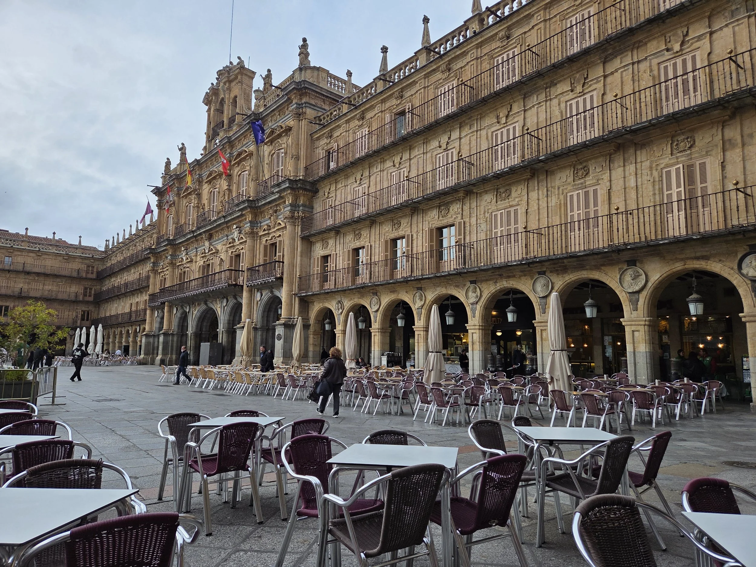
Salamanca at the end of this section is one of the great university cities of Europe — golden sandstone architecture, the oldest university in Spain, a Plaza Mayor widely considered the finest in the country. After two weeks of empty farmland and small towns, Salamanca feels like an arrival.
Stages:
Cáceres → Casar de Cáceres (11km) → Cañaveral (28km) → Grimaldo (14km) → Plasencia (22km) → Aldeanueva del Camino (24km) → Baños de Montemayor (8km) → Béjar (14km) → Calzada de Béjar (11km) → Salamanca (25km via San Pedro de Rozados)
Infrastructure between towns on this section can be minimal to non-existent. Some stages have no bar, no shop, and no water source for 15 to 25km at a stretch. Carry more provisions than you think you need and plan your daily distances conservatively. The Vía rewards the prepared pilgrim and penalises the overambitious one. There is no one to pick you up if you have to stop.
Section 3 — Salamanca to Puebla de Sanabria (~220km · 9 to 10 days)
Walking November 2026. Full guide coming.
The Castilian section. The route north from Salamanca crosses the open meseta of Castile — wide wheat plains, long straight roads, the medieval city of Zamora on the Duero river — before climbing into the hills of Sanabria as the route approaches the Galician border.
Zamora is one of the most undervisited cities on any Camino route. A compact, perfectly preserved Romanesque city on a bluff above the Duero, with more Romanesque churches per square kilometre than anywhere else in Europe. Worth a full rest day.
Puebla de Sanabria, at the end of this section, is a fairy-tale medieval town above a lake — the Lago de Sanabria, the largest glacial lake in Spain. It marks the approach to Galicia and the final section of the route.
Stages:
Salamanca → El Cubo de la Tierra del Vino (36km) → Zamora (32km) → Montamarta (19km) → Granja de Moreruela (23km) → Tábara (25km) → Santa Marta de Tera (23km) → Mombuey (37km) → Puebla de Sanabria (31km)
The El Cubo and Mombuey stages at 36km and 37km are the longest on this section. Both can be split — check accommodation options in advance as services are limited.
Route note: at Granja de Moreruela, north of Zamora, the Vía de la Plata divides. One branch continues to Astorga and joins the Camino Francés for the final section to Santiago. The other — the Camino Sanabrés — heads northwest through Puebla de Sanabria directly to Santiago via Ourense. We walk the Sanabrés. It is the more direct, more solitary, and in our view the more rewarding choice.
Section 4 — Puebla de Sanabria to Santiago de Compostela (~270km · 10 to 12 days)
Walking 2027. Full guide coming.
The Galician section — the Camino Sanabrés. From Puebla de Sanabria the route crosses into Galicia through the mountains, descending through the thermal city of Ourense before the final approach to Santiago through Romanesque villages and chestnut forests.
The crossing from Castile into Galicia is the most dramatic moment of this section — the landscape transforms as completely as it does on the Camino Francés at O Cebreiro. The dry Castilian plateau gives way to green Galician hills, granite villages, and the smell of eucalyptus and rain.
Ourense is the gateway to Galicia on this route — a city built around natural thermal pools that have been used since Roman times. After weeks of walking through empty countryside, the thermal baths are worth an afternoon.
Stages:
Puebla de Sanabria → Lubián (30km) → A Gudiña (24km) → Vilavella (24km) → Ourense (35km) → Cea (26km) → Lalín (28km) → A Laxe (24km) → Santiago de Compostela (25km)
The Ourense stage at 35km is the longest on this section. It can be split at Xunqueira de Ambía. The final stage into Santiago from A Laxe follows the same approach used by all Camino routes — the old city appears at the end of a medieval street and the Plaza del Obradoiro opens before you.
We walk this section in September 2026. The full guide — with our own photographs, journal entries, and practical notes — will be published on our return. If you are planning the Sanabrés and want to talk through the route before then, get in touch.
Want a less solitary route? See the Camino Frances.